We recommend to manage your geodesy configuration database from the "Eye4Software Coordinate Calculator" which is a freeware tool which is shipped with Hydromagic. To start the "Coordinate Calculator", select "Geodesy Calculations" => "Coordinate Conversion..." option from the "Tools" menu as shown below:
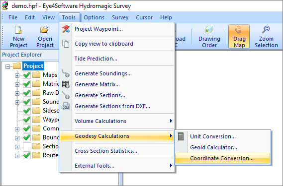
Select the "Coordinate Conversion..." option to start the Coordinate Calculator.
The database containing all geodesy definitions, like ellipsoids, datums, coordinate systems and correction grids is stored in the "C:\ProgramData\Hydromagic\Database\" folder, and it is shared by multiple applications, like Hydromagic Survey, Hydromagic Dredging and the Coordinate Calculator. Most of its content has been taken from the EPSG geodetic database and it will be updated regularly.
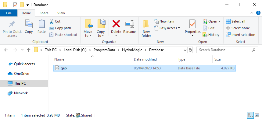
All geodesy definitions are stored in a shared database file.
To open the "Manage Countries" window, select "Options" => "Preferences" => "Manage Countries..." from the menu. Using this window, you will be able to view, delete or modify existing country / region definitions, or to add your own.
NOTE: The use of countries or regions is not required to perform coordinate calculations. It is only added to provide a mechanism to sort the map grids by the region or country they are used for.
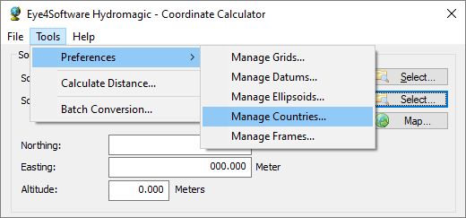
The "Countries" dialog can be opened from the "Tools" menu.
When clicking an item in the list, its parameters are displayed below the list (country name and flag file name). You can edit these parameters by clicking the "Modify" button.
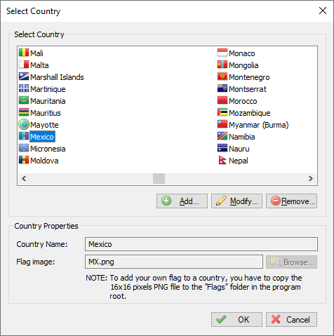
Click a country to view or alter its properties.
You can delete a country definition, by selecting an item from the list and clicking the button "Delete". The software will show a popup to confirm that you are sure you want to delete. Please note that you cannot delete countries that are currently being used in a grid definition.
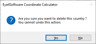
You have to confirm deletion of a country definition.
You can modify a country by clicking the "Modify" button after you selected a country from the list. You can for instance translate the country name to your own language, or modify previously created regions.
The flag associated with the country or region can be changed by clicking the "Browse" button. How to add your own symbols or flags is described in the "Adding a country" section below.
After clicking the "Modify" button, the "OK" button text will change to "Save". Clicking the "Save" button will save the modifications, clicking "Cancel" will keep the old data.
To add a new country definition, click the "Add" button. When adding a new definition, it is required to specify a name for this country. Specifying a symbol or flag for this country is optional, when no image has been specified a globe is displayed in the grid list.
In case you want to add your own symbol, convert this symbol to a 16x16 PNG Image file and copy this file to the "Flags" folder in the program directory. You can select a flag or symbol by clicking the "Browse" button. The software ships with flags for most countries around. Click the "Save" button to store the newly created datum, by clicking cancel the input is ignored and you will return to the list.