
Eye4Software Hydromagic
Hydromagic introduction
Eye4Software Hydromagic is a professional hydrographic survey package, which can be used to map depth areas using an echo sounder and GNSS receiver. The software is very affordable and the learning curve is very short. You can start creating your first sounding within a single day. Our website contains a lot of free training material so you will be able to learn the software without expensive courses. A free demo version package, is available on the download page.
Some application examples
- Record sounding data using a (hydrographic) echo sounder and GNSS (RTK) receiver;
- Calculate volumes of river sections, pits, ponds, lakes and reservoirs, for instance in the mining industry;
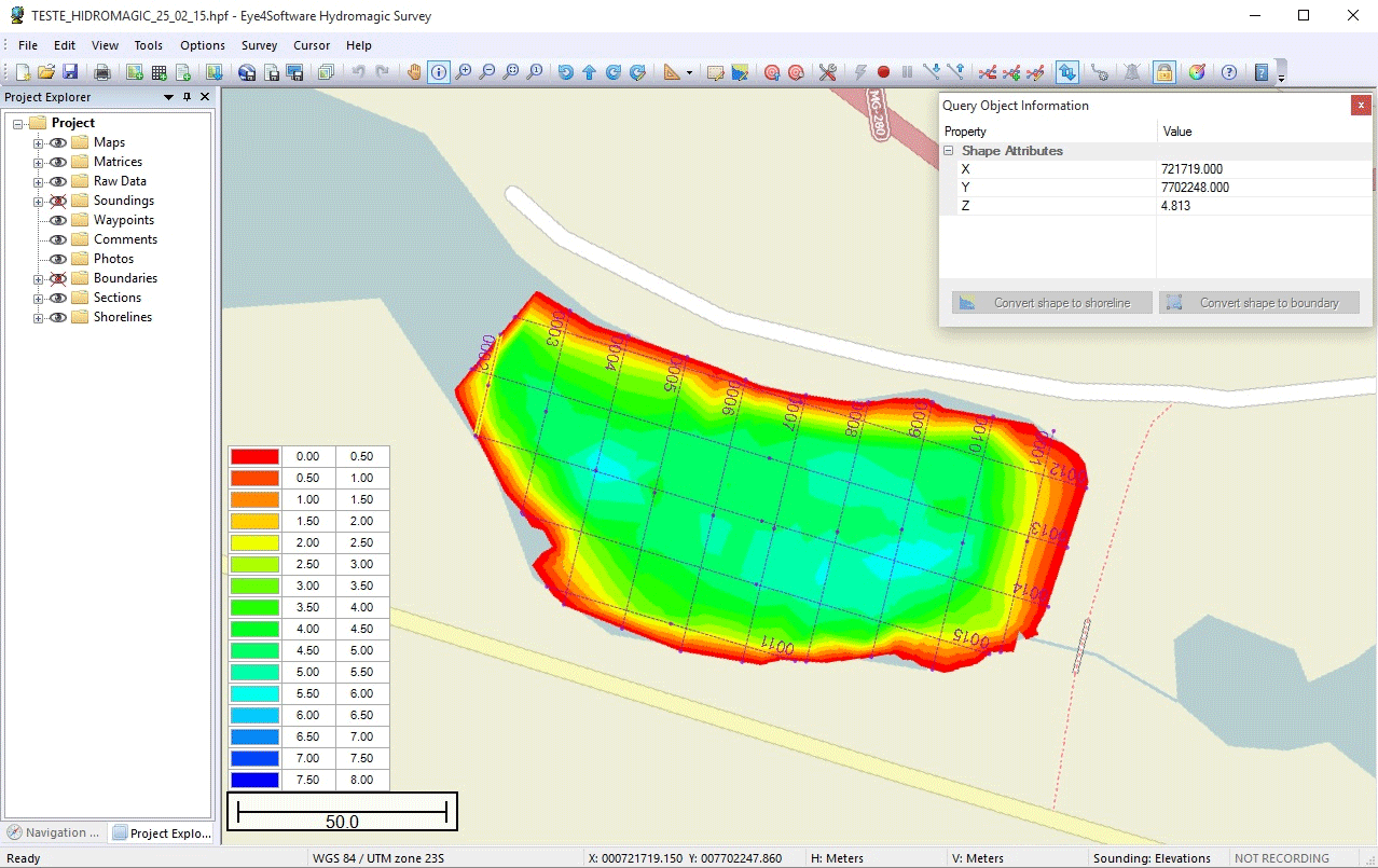
- Create depth contours and save them as AutoCAD DXF or Google Earth, ESRI Shape or KML/KMZ files;
- Create a regularly spaced grid(s) from sounding data, and export it as DXF, KML or ASCII file;
- Calculate tide levels using a RTK receiver, using a provided antenna height and loaded geoid model;
- Use the built in coordinate calculator to convert hydrographic data files between different map projections.
Screenshots


Hardware and Geodesy Support
 Support for GNSS (RTK) receivers
The software can communicate with almost any (NMEA0183 compatible) GPS or RTK receiver to retrieve your current position and height, and show it on one of the support raster or vector maps. In addition, with a RTK receiver, you can calculate tide levels in real-time.
 Support for echo sounders
Hydromagic offers support for a wide range of professional single and dual frequency hydrographic echo sounders from popular brands like CEE HydroSystems, BathyLogger, EchoLogger, Syqwest and more.
 Support for other sensors
Besides GNSS and echo sounder, also other hardware, such as a tide receiver, magnetometer, motion or tilt sensor, heading sensor (compass) or an AIS receiver can be connected. for a full list of supported echo sounders and other hardware click here.
 Geodesy
To display a part of the globe on a display, a map projection is needed to prevent distortion of the map data. The software is shipped with a database containing over 5000 predefined local and global map datums and map grids.
Product Features
 Background maps
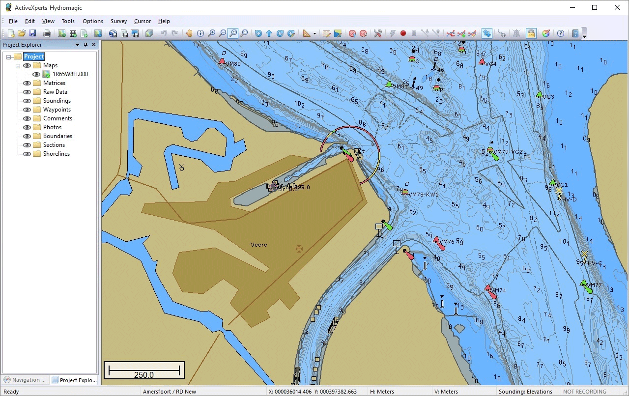
- Import AutoCad DXF, MicroStation DGN and GeoTIFF files as background map
- Use electronic nautical charts, IHO S57 and IHO S63 maps are supported
- Built-in map downloading tool lets you download map data from sources like OpenStreetMaps, Bing Maps and more
- Geo-reference scanned maps, or use image files with accompanied world file
 Data display and recording
- Real time display of incoming data like position data, sounding depth and motion sensors
- Real time tide correction when a RTK positioning system is used and a geoid model is loaded
- Map display showing the actual position of the vessel
- Time tagged recording of all raw data including latency information
 Raw data processing
- Correct your sounding data for tides, draft and sound velocity
- Built in filter tool to remove out of range sounding data
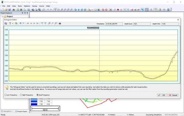
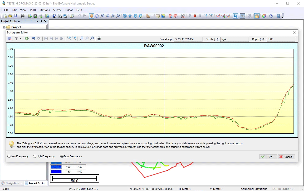
- Echogram editor and filter to manually or automatically remove spikes from the sounding data
- Position editor and filter to manually or automatically remove invalid position fixes
- A table editor allows you to edit all values by hand
 Post processing
- Generate matrix (also called digital terrain model) from filtered and corrected sounding data
- Volume calculations by comparing different matrices
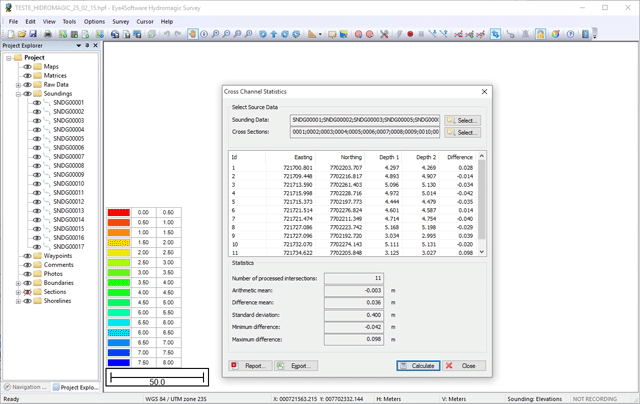
- Volume calculations using cross sections (channels)
- Staging reports for ponds and frac pits
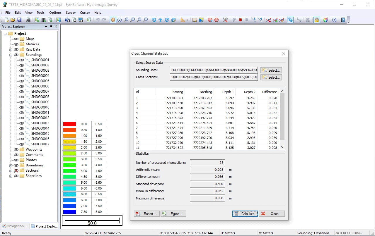
- Cross section statistics
- AutoCad DXF, Google KML and ASCII exporting functions