
Loading IHO S-57 ENCs
S-57 is a standard for electronic navigational charts defined by the IHO (International Hydrographic Organization). S-57 is used for most official hydrographic charts. Hydromagic supports both unencrypted and encrypted (S-63) charts. It is a vector format that contains features (lines, areas, and points) and attributes like depth, symbols, lights, etc.
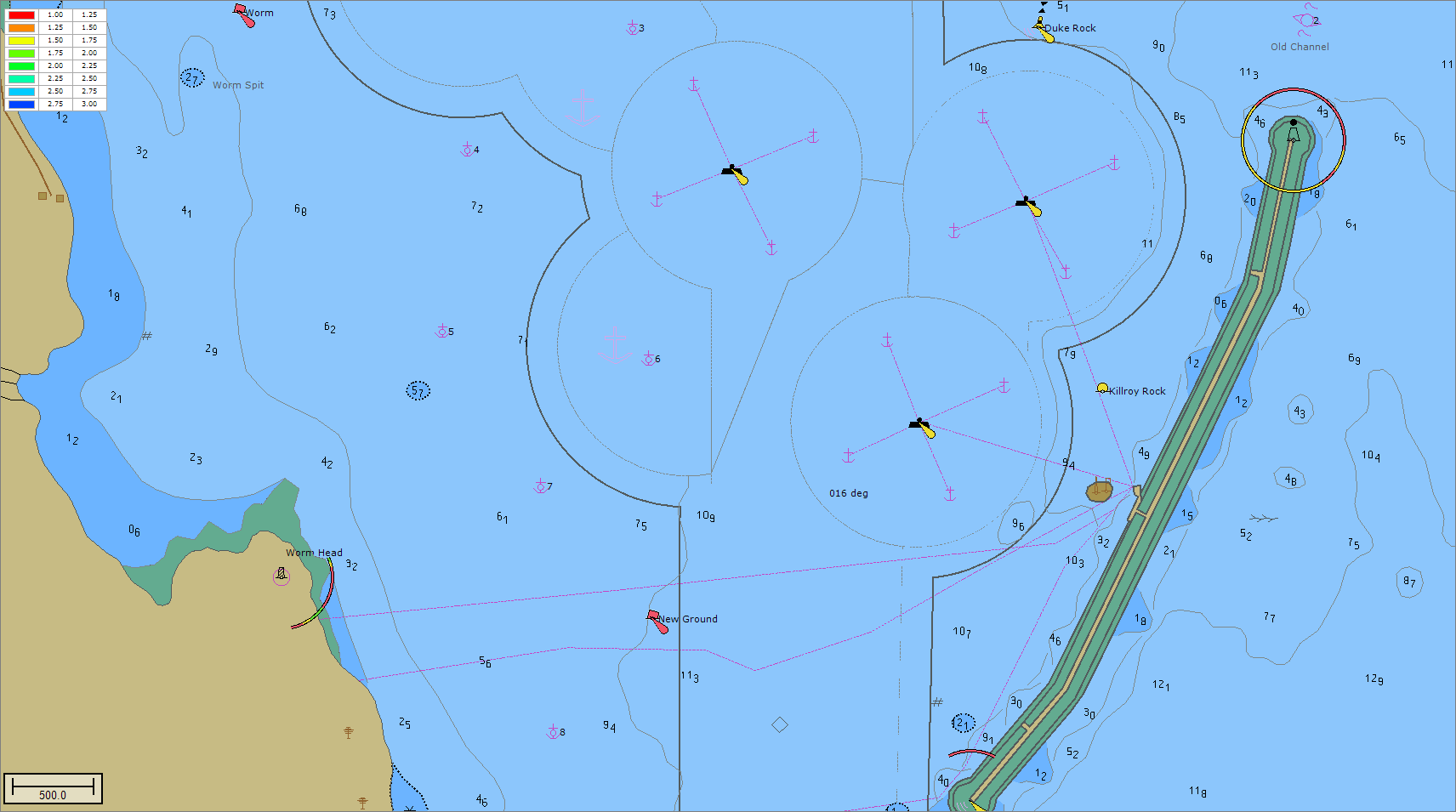
Example of an S-57 Electronic Navigational Chart or ENC.
S-57 charts
S-57 charts are available online (for free) for the following countries:
- United States (Inland and coastal waters);
- Austria (Inland);
- Belgium (Inland);
- Bulgaria (Inland);
- Croatia (Inland);
- Czech Republic (Inland);
- Germany (Inland);
- Hungary (Inland);
- Netherlands (Inland);
- Romania (Inland);
- Serbia (Inland);
- Slovakia (Inland);
- Swiss (Inland).
A more detailed list of sources for S-57 data can be found on our website: https://www.eye4software.com/hydromagic/documentation/download-s-57-encs/. For other countries, data can only be purchased in S-63 format. S-63 is the encrypted version of S-57 charts, also called SENC's (System Electronic Navigational Charts). For more information on S-63, please refer to the next chapter.
ENC Downloader
When you need navigational charts for the United States, you can also use the built-in ENC downloader function (from Hydromagic version 9.0). This map downloader can be launched by selecting the "Download ENC..." function from the "File" menu, or by clicking the "Download ENC" button in the toolbar.
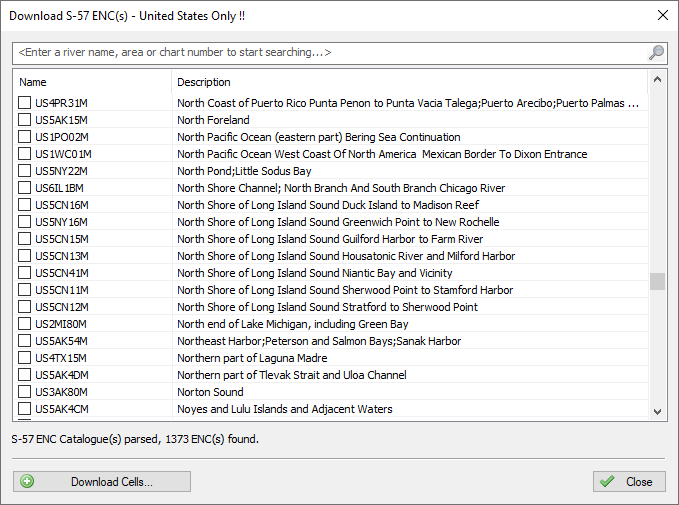
For the United States, you can use the built in ENC download tool as well.
Loading S-57 charts
IHO S-57 charts can be loaded into Hydromagic by right-clicking the 'Maps' folder in the 'Project Explorer' and selecting the 'Import Map...' option as shown in the screenshot below. The file extension for both S-57 and S-63 charts is '.000. The software will auto-detect whether the selected chart is encrypted (S-63) or not.
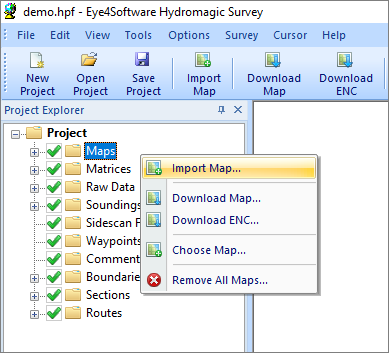
Right click the "Maps" folder in the "Project Explorer"
to add a new ENC to the project.