When recording data, nothing is displayed on the map, how can I fix this issue ?
When recording is started, and your vessel is moving, all positions recorded to the raw data file should be shown on your background map.
If this is not the case, please check one of the following:
Visibility
Make sure your raw file(s) are visible. You can toggle the visibility of any object by clicking the "eye" icon in front of the item in the "Project Explorer".
When the "Project Explorer" isn't shown, you can unhide it by selecting "Project Explorer" from the "View" menu.
Color ranges
When you configured your raw files to shop up in colors, make sure the depth is within one of the defined color ranges, otherwise you won't see anything.
To change color ranges, click the "Color Ranges" on the toolbar.
Raw data display settings
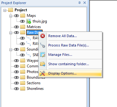
Finally, you can check the display settings for raw files. These settings can be opened by right-clicking the "Raw Data" folder in the "Project Explorer" and selecting the "Display Options..." option from the popup menu.