
I want to use GEOID18B for the United States, how do I know which zone I must use?
The GEOID18 model for CONUS (the The contiguous United States) is divided into eight (8) zones to reduce file size and reduce lookup times.
To determine which geoid zone you have to use, please have a look at the table below:
| Zone No. | Latitude Range (N) | Longitude Range (W) |
|---|---|---|
| 1 | 40-58 | 130-111 |
| 2 | 40-58 | 113-94 |
| 3 | 40-58 | 96-77 |
| 4 | 40-58 | 79-60 |
| 5 | 24-42 | 130-111 |
| 6 | 24-42 | 113-94 |
| 7 | 24-42 | 96-77 |
| 8 | 24-42 | 79-60 |
The following map which is published on the NOAA/NGS website, also allows you to lookup the zone for your state. Please note that the zones overlap for two degrees.
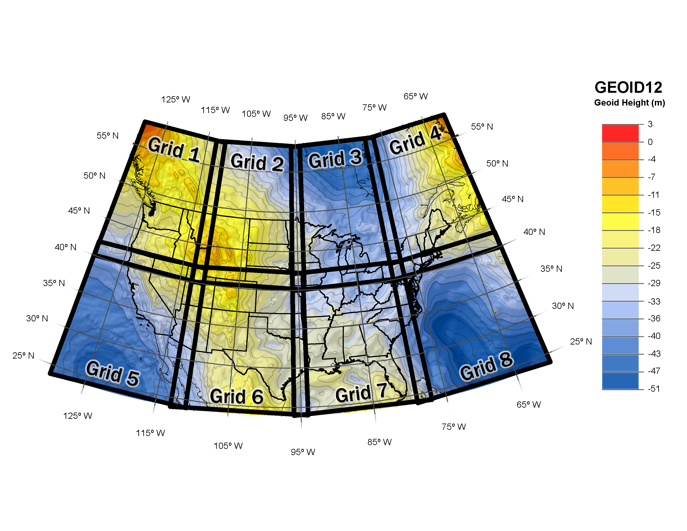
Image courtesy of NOAA(NGS)